Hey guys,
Here is something I posted over on "the" forum. Hope you find it convincing.
Here is a pretty good example of something we should not see.
It is from the village hermanville in north France to le Havre, a well known port village, and the mountains above it.
The pictures I got from google maps street view and from heywhatsthat.com, a website for viewing the contours of land at any given spot.
Here first map view of the place in question

It is from the pink X to the black X. It is this side profile which is shown below
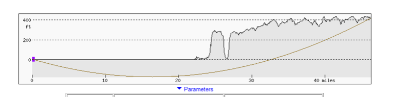
For the earth curve calculator we are going to take 40 miles. You can see the elevation from the above image. It is just over 400 feet approximately.
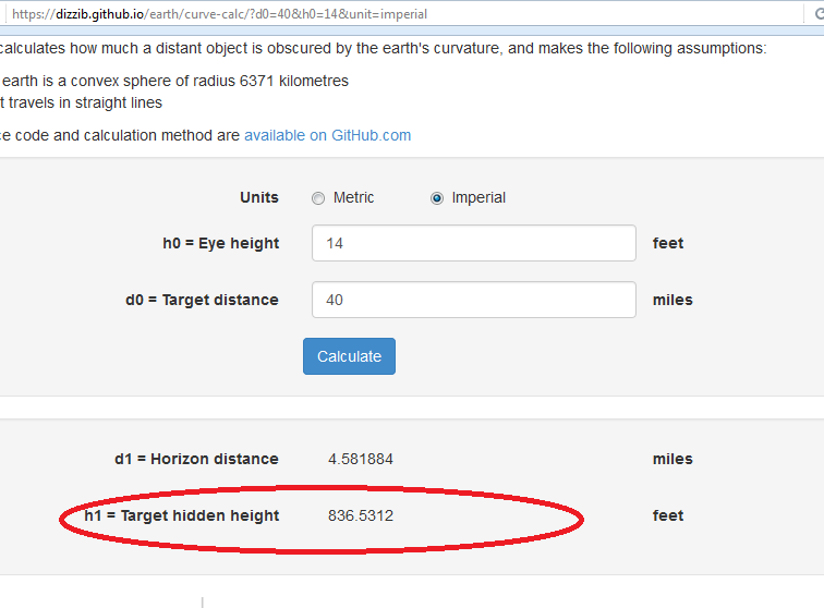
We have given an allowance of 14 feet height for the camera from sea level. Pretty generous. Giving a few more feet will not alter our results significantly or detract from the point of the experiment as you will see.
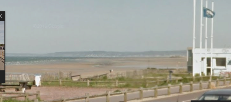
Here is what we see
Here is what the earth curve calculator gives me. A whopping 836 feet. That's nearly 400 feet below the horizon. This would be impossible on a round earth.
Now the first objection usually given is refraction. That is why we took images from a sunny (warmer day) and a cooler cloudy day. There would be a variance in temperature and humidity, important factors in creating refraction and/or superior mirages.
Here are the results
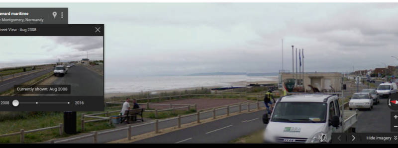
A cloudy day
The first image was a sunny day.
Here are the two side by side, in case anyone thinks we are cheating with the different points at which the photo was taken

 Topic: 50 Plus Reasons The Earth Is Not Flat (Read 340471 times)